UN
8 Carvel Way
£ 330,000
Description
We don't have a Description for this property.
- Bedrooms
- 4
- Bathrooms
- 0
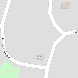

Leaflet © OpenStreetMap contributors
The heatmap indicates the level of crime in the area. The color of the heatmap indicates the crime severity and recency.
Metrics Year-on-Year
- Average area value
- 761,083.00 £Increased by 6.90 %
- Average area rental value
- 2,056.00 £/moDecreased by 3.34 %
- Est rental Yield
- 3.24 %Decreased by 9.75 %
- Crime Rate
- 8.00 %Unchanged by 0.00 %
from 711,963.00 £
from 2,127.00 £/mo
from 3.59 %
from 8.00 %
Nearby Schools
| Name | Type | Ofsted | Distance |
|---|---|---|---|
| Rustington Community Primary School | Academy Converter | Good | 1.11 KM |
| Summerlea Community Primary School | Community School | Requires improvement | 1.12 KM |
| The Littlehampton Academy | Academy Sponsor Led | Requires improvement | 1.33 KM |
| Cornfield School, Littlehampton | Community Special School | Good | 1.53 KM |
| St Catherine'S Catholic Primary School, Littlehampton | Voluntary Aided School | Requires improvement | 1.86 KM |
Images
Nearby Streets
| Name | Average Price | Average Sqft | Distance |
|---|---|---|---|
| The Chine | £ 0 | 0 | 0.00 KM |
| Hollyhock Drive | £ 0 | 0 | 0.00 KM |
| Horsham Road | £ 242,000 | 0 | 0.00 KM |
| Harebell Close | £ 427,500 | 0 | 0.00 KM |
| Rustington Bypass | £ 210,000 | 0 | 0.00 KM |
Nearby Transport
| Name | NLC | TLC | Distance |
|---|---|---|---|
| Littlehampton | 5260 | LIT | 2.53 KM |
| Angmering | 5267 | ANG | 3.78 KM |
| Arundel | 5251 | ARU | 4.57 KM |
| Ford | 5258 | FOD | 6.32 KM |
| Amberley | 5250 | AMY | 9.43 KM |
Nearby Listings
| Address | Price | Type | Score | Distance |
|---|---|---|---|---|
| Littlehampton | £ 295,000 | BUY | 6 / 10 | 0.01 KM |
| Carvel Way, Littlehampton, West Sussex | £ 325,000 | BUY | 6 / 10 | 0.02 KM |
| Davits Drive, Littlehampton, West Sussex | £ 275,000 | BUY | 5 / 10 | 0.05 KM |
| Carvel Way, Littlehampton | £ 165,000 | BUY | Unknown | 0.07 KM |
| Beacon Way, Littlehampton | £ 290,000 | BUY | 6 / 10 | 0.08 KM |
Nearby Properties
| Address | Price | Distance |
|---|---|---|
| 29 Carvel Way | £ 197,500 | 0.00 KM |
| 9 Carvel Way | £ 245,000 | 0.00 KM |
| 47 Carvel Way | £ 220,000 | 0.00 KM |
| 2 Carvel Way | £ 265,000 | 0.00 KM |
| 42 Carvel Way | £ 175,000 | 0.00 KM |